
What makes Richmond different from other East Bay cities? Its shoreline, industrial history and neighborhoods are closely connected: the railroad and port helped establish the city, and World War II shipbuilding transformed it. Today, that story sits alongside waterfront walks, community arts, farmers markets and neighborhoods that deserve to be understood individually.
City guide · East Bay
Richmond, California: Shipyard History, Shoreline and Neighborhoods

Richmond existed before the shipyards
Richmond's history does not begin with World War II. The area is Ohlone homeland; later came the Rancho San Pablo land grant and an industrial town built around rail and waterfront access. The City's historical account traces the Santa Fe Railroad's arrival and early refinery development before Richmond incorporated in 1905.
That foundation helps explain why wartime industry could grow here. Richmond already had transportation links and an industrial waterfront. What happened next changed far more than the shoreline.
How World War II changed the city
Kaiser's Richmond shipyards drew workers and their families from across the country. The National Park Service's history of the workforce describes people of different racial, ethnic and cultural backgrounds contributing to the war effort, including African American, Latino, Asian American, Native American and immigrant workers. Women entered industrial jobs in large numbers, becoming part of the history remembered through Rosie the Riveter.
The scale was extraordinary: the Richmond shipyards built 747 ships during WWII. Shipbuilding was only part of the work. The Ford Assembly Plant shifted from civilian automobile production to assembling jeeps and preparing military vehicles for service.
Workers needed homes, medical care, schools and childcare. Richmond's wartime growth therefore reshaped daily life as well as employment. The National Park Service documents both the support systems and their inequities: expanded healthcare and childcare existed alongside discriminatory housing practices. Shared participation in the war effort did not mean everyone received equal treatment or opportunity.
That is an essential part of Richmond's story. The city was shaped by the people who arrived, the work they did and the communities they built—not simply by the ships that left its waterfront.
Rosie the Riveter: more than an image
The Rosie the Riveter/WWII Home Front National Historical Park connects that national story to real places and people in Richmond. The Visitor Education Center, at 1414 Harbour Way South, occupies the former Oil House within the historic Ford complex. It is a useful starting point for understanding the home front before exploring the waterfront.
The outdoor Rosie the Riveter Memorial is a separate destination in Marina Bay Park. Our Marina Bay guide covers that setting in more detail. The visitor center and memorial should not be confused with one another.
Westin's perspective: my connection starts at the waterfront
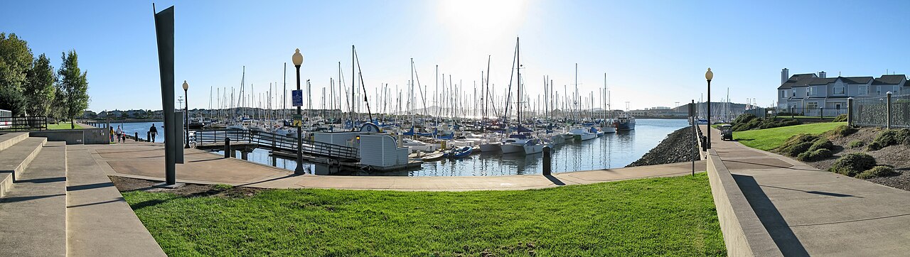
I lived in the Richmond Marina area for about four to five years in the early 2000s. The shoreline and trips to Point Richmond are a big part of my memories here. It is also a place I have watched change: there are more reasons to spend time around the waterfront now, beyond the walks and bike rides I remember.
That is my personal starting point in Richmond, not the whole city. Its shipbuilding history and the communities that grew around it deserve just as much attention as the waterfront people see today.
Beyond the marina: art and a different stretch of shoreline
Richmond Art Center brings exhibitions, classes and community arts into the Civic Center area. It offers a different way to spend time in Richmond from a waterfront outing: looking at work, learning a technique or checking the current exhibition calendar.
Farther north, Point Pinole Regional Shoreline has trails, open space and views over San Pablo Bay. It is a separate park outing, not an extension of a short Marina Bay stroll. Check the park district's maps and access notices before visiting.
Two farmers markets, two parts of Richmond
Richmond Certified Farmers Markets lists:
- Civic Center: Fridays, 7 a.m.–1 p.m., at 325 Civic Center Plaza, in front of the library.
- Marina Bay: Sundays, 10 a.m.–2 p.m., in the Marina Bay Park parking lot off Regatta Boulevard and Melville Square.
Market details checked September 30, 2026. Times are local; check the operator for holiday closures and schedule changes.
Explore Richmond neighborhood by neighborhood
Marina Bay focuses on shoreline paths, marina dining, the Sunday market and nearby waterfront destinations. Point Richmond has a different center of gravity: village streets, coffee, local gathering places and the shoreline beyond the tunnel.
These two guides are starting points, not a complete map of Richmond. The city overview will connect additional neighborhood guides as that coverage grows.
If you have questions about a particular part of Richmond, I would be glad to hear what you want to know.
Sources & local information
Business and visitor details can change. Follow the original sources for current information.
- City's historical account
- National Park Service's history of the workforce
- Richmond shipyards built 747 ships during WWII
- Ford Assembly Plant
- National Park Service documents both the support systems and their inequities
- Visitor Education Center
- Richmond Art Center
- Point Pinole Regional Shoreline
- Richmond Certified Farmers Markets